Backroad Mapbooks
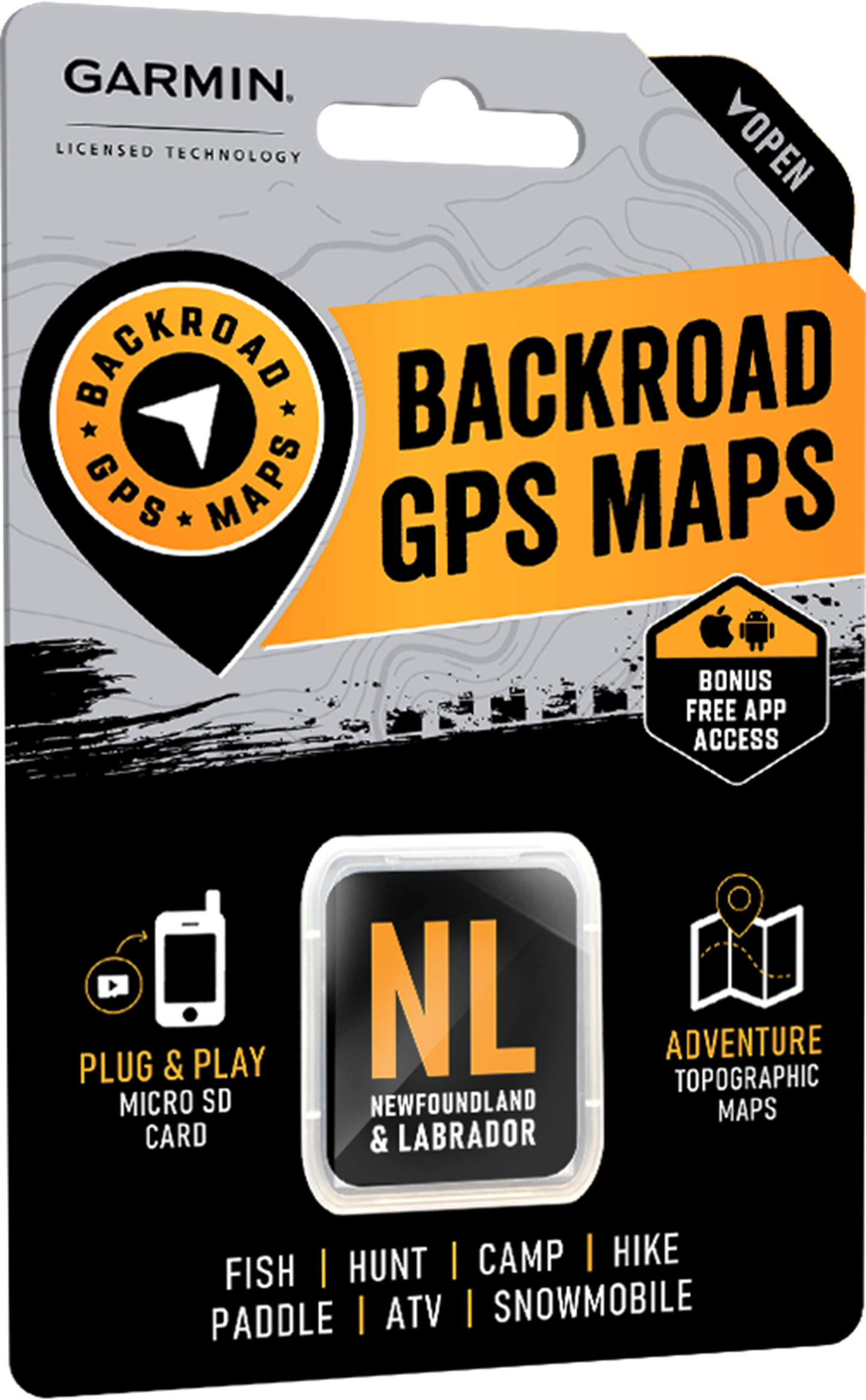
Backroad Maps GPS TOPO for Garmin Handhelds - SD Card - Newfoundland & Labrador
Backroad Maps GPS TOPO for Garmin Handhelds - SD Card - Newfoundland & Labrador
Couldn't load pickup availability
Discover Canada’s Eastern Reaches
Found in Canada’s far east, Newfoundland can seem like a world away from the rest of the country. Dramatic ocean coast, uncharted wilderness, centuries-old fishing villages, picturesque lighthouses and a distinct charisma add up to make this a must-visit destination for backroad explorers and outdoor adventurers. Whether you are visiting the capital of St. John’s, one of North America’s oldest cities, or taking in the beauty of the UNESCO World Heritage Site of Gros Morne National Park, there is lots to discover. A short ferry ride to the north, Labrador is a sparsely populated haven for intrepid recreationists, with majestic fjords carved into the coastline and icebergs and whales visible just offshore. Whether exploring on foot, kayak, boat, bicycle, ATV or four-wheel drive, you can count on our GPS Maps to help you make the most out of your adventures in Newfoundland and Labrador.
Newfoundland & Labrador Backroad GPS at a Glance
- Combining day-to-day navigation with enhanced outdoor recreation information, this product combines all of Newfoundland and Labrador into one Backroad GPS Map.
- Over 39,000 km of our backroads network combined into one map, including over 20,000 km of routable roads.
- Marked Cariboo Management Areas (CMA) and Moose Management Areas (MMA) for hunters.
- Address Search tool makes navigating easier than ever.
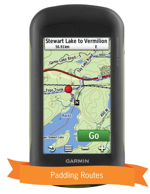
- Thousands of kilometres of ATV Trails, snowmobile routes, multi-use hiking, biking and cross-country skiing trails and paddling routes, with marked trailheads and access points/portages.
- Thousands of fishing hotspots, parks and conservation areas, campsites, hunting areas, winter recreation areas and more.
- Over 25,000 land and water geographic features.
- Enhanced cartography for improved display of parks, conservation areas, creeks and activity Points of Interest.
- Improved snowmobile route lines, First Nations reserve coverage and railway corridor mile markers.
Newfoundland & Labrador Backroad GPS Map Features
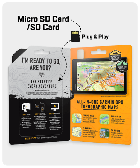
- Garmin-licensed & compatible with Garmin GPS™, Basecamp™, MapSource™ and RoadTrip™.
- Includes all standard Garmin features such as Find tool, city navigation and more.
- Preloaded 1:20,000 / 1:50,000 base scale seamless topographic maps.
- Provides 3D views and the highest level of map detail available on select Garmin GPS units and Basecamp™.
- Compatible with the latest Garmin 66i unit and inReach technology.
- The most complete Resource, Industry, and Logging road coverage available for Newfoundland & Labrador.
- Extensive routable road network including City, Resource, and Industry Roads.
- Highlights tens of thousands of kilometres of trail systems, including defined ATV, Paddling, Snowmobile, Long distance & Multi-use trails.
- Features smart background & Searchable Cariboo Management Areas (CMAs) and Moose Management Areas (MMAs) for hunters.
- Includes National, Provincial, Regional, and other Parks & Campsites.
- Extras like Lake & Stream Fishing information with boat launches, paddling access points and more.
- Searchable BRMB descriptions and activity information for fishing, paddling, parks, trails and more.
- Thousands of Searchable cities, Geographic Land, and Water features.
- Features Address searching to aid navigation.
- Industry leading cartographic contours and shaded relief for all of Newfoundland and Labrador.
- Improved snowmobile route lines, First Nations reserve coverage and railway corridor mile markers.
- And much more!
Share