

1
/
of
3
Backroad Mapbooks
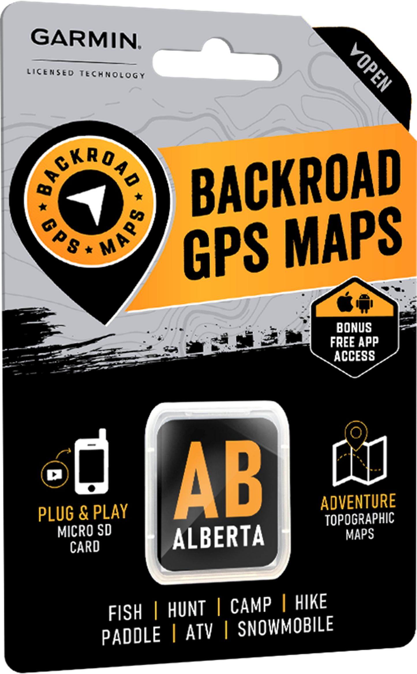
Backroad Maps GPS TOPO for Garmin Handhelds - SD Card - Alberta
Backroad Maps GPS TOPO for Garmin Handhelds - SD Card - Alberta
Regular price
$150.00
Regular price
Sale price
$150.00
Shipping calculated at checkout.
Quantity
Couldn't load pickup availability
Alberta
Be Your Own Guide with Version 2020 GPS Maps for Alberta
Industry Leading Topographic Contours and Shading
What's new in Version 2020:
- BRMB GPS Maps are compatible with the new Garmin 66i unit with inReach technology
- Added 2800+ km of motorized trails for ATV's and Snowmobiles including close to 70 new trailheads and staging areas
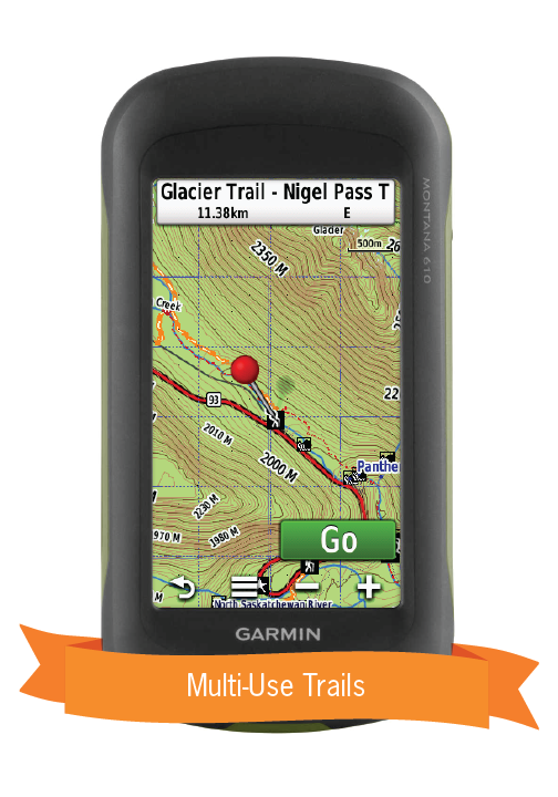
- Added close to 550 km of Multi-Use Trails including the Trans Canada Trail with 265+ new trailheads
- Added 70 km of Paddling Routes including close to 50+ new access and portage locations
- Now includes Livingstone and Porcupine Hills Public Land Use Zones
- Now includes Birch Mountains, Birch River, Dillon River, Kazan and Richardson Wildland Provincial Parks plus close to 30 new Provincial, National and Urban Parks including 90+ new Campsites, Backcountry Campsites, Day Use/Picnic Areas, Recreation Areas and Huts/Shelters
- 60+ new Wildlife Viewing point of interest including Scenic Areas and Fire Towers
- Added close to 60 new Winter Recreation adventures for cross-country skiing and snowshoeing
- Added close to 150 new First Nations Reservations
- Added thousands of mile markers along Railway Corridors
- Enhanced the Snowmobile Route cartography for improved display
So Much More Than Just Maps!
Alberta GPS Map Features
- Over 5.3 million searchable Oil and Gas LSD Grid locations
- Over 5,000 Compressor Stations
- Close to 700 Gas Plants
- Over 30,000 Resource Facilities
- Over 43,000 Wellsites
- Over 410,000 km of our backroads network combined into one map, including close to 320,000 km of routable roads.
- Close to 200 Wildlife Management Units (WMU) for hunters
- Fishing Lakes and Rivers with over 1,400 locations with descriptions and fish species
- Over 260 Boat Launch locations
- Over 1,900 Trails with front country and backcountry locations and descriptions, or 17,500+ km of trails in total
- ATV Trails with close to 300 trailhead locations and descriptions, or 7,400+ km of trails in total
- Snowmobile Trails with over 240 trailhead locations and descriptions, or 7,700 km+ of trails in total
- Over 1,900 National, Provincial and Regional Park locations and descriptions
- Recreation Areas with over 230 locations and descriptions
- Over 420 Backcountry campsites
- Over 700 Campground and Picnic locations
- Close to 800 paddling route access points descriptions and portage locations
- Wildlife Viewing with 400 locations and descriptions
- Over 300 Winter Recreation Sites and Downhill Ski Areas
- Close to 2,500 City, Town and Community locations
- Over 16,000 searchable land and water geographic features
- 110 Backcountry Huts and Cabins
- Address and Township & Range Search for easier than ever navigation.
- Lake Bathymetry depth contour for over 150 fishing lakes, rivers, and streams.
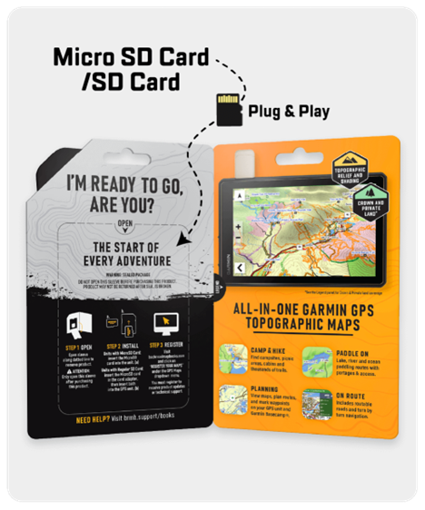
- Garmin-licensed & compatible with Garmin GPS™, Basecamp™, MapSource™ and RoadTrip™.
- Includes all standard Garmin features such as Find tool, city navigation and more.
- Preloaded 1:20,000 / 1:50,000 base scale seamless topographic maps.
- Provides 3D views and the highest level of map detail available on select Garmin GPS units and Basecamp™.
Share