
Backroad Mapbooks
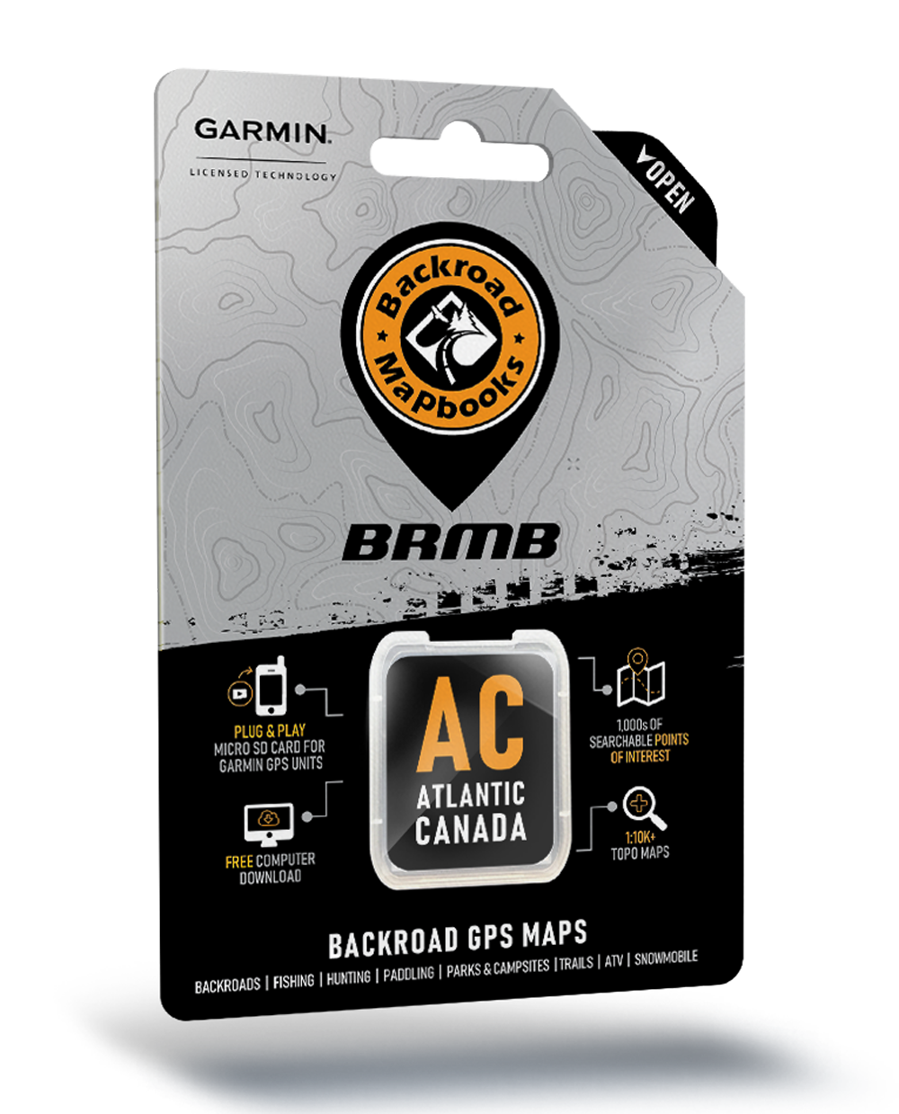
Backroad Mapbooks GPS Maps - SD Card Atlantic Canada
Backroad Mapbooks GPS Maps - SD Card Atlantic Canada
Couldn't load pickup availability
Atlantic Canada
Be Your Own Guide with Version 2019 GPS Maps for Atlantic Canada!
Home to some of the country’s oldest communities and boasting a rich tradition of love for the outdoors, Atlantic Canada is a land rife with adventure opportunities, from New Brunswick to Nova Scotia, Prince Edward Island and Newfoundland and Labrador. Whether you are hiking, cycling, canoeing, kayaking, ATVing, hunting, fishing, viewing wildlife, skiing or snowmobiling, our Version 2019 GPS Maps are you ultimate guide to outdoor adventure in Atlantic Canada.
Industry Leading Topographic Contours and Shading
These Garmin-licensed GPS Maps feature the height of cartographic sophistication, giving you the most detailed, easy-to-use and comprehensive maps available for Atlantic Canada.
What’s New in Version 2019:
- BRMB GPS Maps are compatible with the new Garmin 66i unit with inReach technology
- Seamless coverage for all of New Brunswick, Nova Scotia, PEI, Newfoundland and Labrador on one GPS Map.
- Over 308,000 km of our backroads network combined into one map, including over 113,000 km of routable roads.
- Labelled Crown Land for all of Nova Scotia and New Brunswick.
- Address Search makes navigating easier than ever.
- Marked Cariboo Management Areas, Deer Management Zones, Moose Management Areas and Wildlife Management zones for hunters.
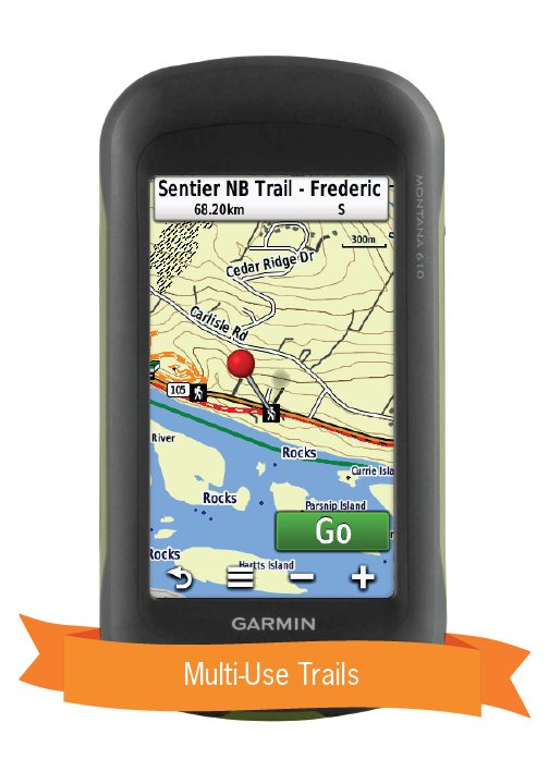
- 4,300+ km of paddling routes for canoers and kayakers, 10,000+ km of multi-use trails for hikers, cyclists, horseback riders, snowshoers and cross-country skiers and 37,000+ km of motorized trails for ATVers and Snowmobilers
- Tens of thousands of fishing hotspots, parks and conservation areas, campsites, hunting areas, winter recreation areas and more.
So Much More Than Just Maps!
Backroad Mapbooks’ industry-leading topographic maps are trusted by recreationists and industry workers alike, and are even the maps of choice for search and rescue organizations. Also included in the GPS Maps are detailed written descriptions of hunting areas, fishing lakes and rivers, national and provincial parks, wildlife viewing areas, multi-use trails and more. Carefully compiled by our team of outdoor writers and researches, these descriptions include information on access, regulations, difficulty, species and more. With thousands of adventures to take on including hiking, camping, ATVing, snowmobiling, canoeing and kayaking, the only problem you will have is deciding where to go first.
Atlantic Canada GPS Map Features:
- Over 170 Atlantic Canada Cariboo Management Areas (CMA), Deer Management Zones (DMZ), Moose Management Areas (MMA) and Wildlife Management Zones (WMZ) for hunters
- Fishing Lakes and Rivers with 1,600+ locations with descriptions and fish species
- 300+ Boat Launch locations
- 1,550+ Trails with front country and backcountry locations and descriptions, or 10,000+ km of trails in total
- Snowmobile Trails with over 270 trailheads/staging areas and descriptions, or 22,000+ km of trails in total
- ATV Trails with over 220 trailheads/staging areas and descriptions, or 14,800+ km of trails in total
- Parks with close to 1,000 National, Provincial, Regional Parks and Conservation Areas with descriptions
- 230+ Backcountry campsites
- 340+ Campground and Picnic locations
- Paddling with 350+ paddling route access points descriptions and portage locations, or 4,300+ km of paddling routes in total
- 195 Winter Recreation Sites and Downhill Ski Areas
- Close to 330 Wildlife Viewing locations and descriptions
- 6,750 City, Town and Community locations
- 62,000+ searchable land and water geographic features
- Over 308,000 km of our backroads network combined into one map, including over 113,000 km of routable roads.
- Labelled Crown Land for all of Nova Scotia and New Brunswick.
- Address Search makes navigating easier than ever.
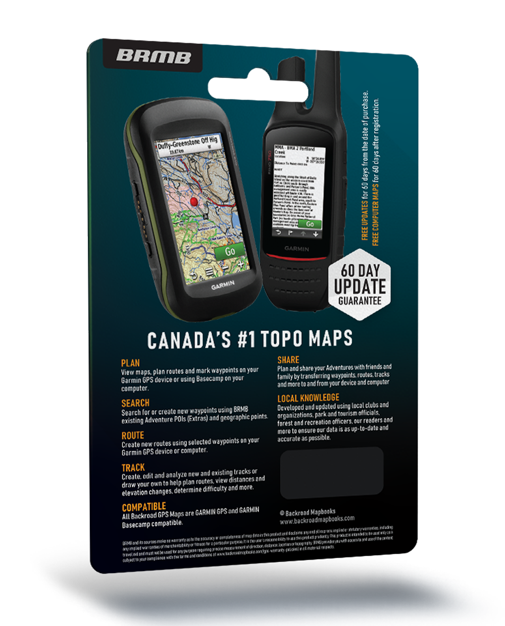
- Garmin-licensed & compatible with Garmin GPS™, Basecamp™, MapSource™ and RoadTrip™.
- Includes all standard Garmin features such as Find tool, city navigation and more.
- Preloaded 1:20,000 / 1:50,000 base scale seamless topographic maps.
- Provides 3D views and the highest level of map detail available on select Garmin GPS units and Basecamp™.
- Searchable BRMB descriptions and activity information for fishing, paddling, parks, trails and more.
- Industry leading cartographic contours and shaded relief for all of New Brunswick, Nova Scotia, Prince Edward Island, Newfoundland and Labrador.


