Backroad Mapbooks
Backroad Mapbooks GPS Maps - SD Card British Columbia
Backroad Mapbooks GPS Maps - SD Card British Columbia
Couldn't load pickup availability
British Columbia
Be Your Own Guide with Version 2020 GPS Maps for British Columbia!
From the wild and wet Pacific coast to the deep valleys and rushing river of the interior and the towering Rocky Mountains to the east, British Columbia is an outdoor adventurer’s paradise. Whether you are looking to fish, hunt, camp, paddle, hike, ski, ATV or just enjoy the sights from your vehicle, our Version 2019 GPS Maps are your ultimate guide to the province.
Industry Leading Topographic Contours and Shading
These Garmin-licensed GPS Maps feature the height of cartographic sophistication, giving you the most detailed, easy-to-use and comprehensive maps available for British Columbia.
What’s New in Version 2020:
- BRMB GPS Maps are compatible with the new Garmin 66i unit with inReach technology
- Enhanced our Routable Roads with 23,000+ km of improvements to our Forest Service Road network, including adding road names and upgrading non-routable roads to routable
- Added 4,450+ km of motorized trails for ATV’s and Snowmobiles including close to 125 new trailheads and staging areas
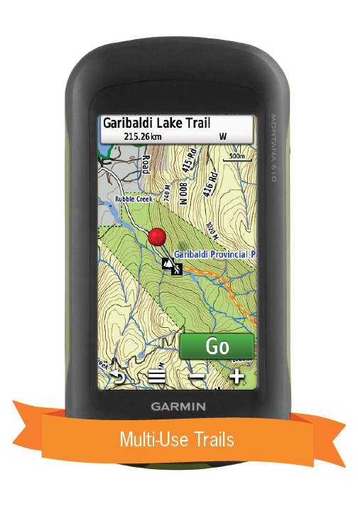
- Added close to 1,500+ km of Multi-Use Trails including the Trans Canada Trail with 350+ new trailheads
- Added close to 400 km of new Paddling Routes including 80+ new access and portage locations
- Added close to 200 new Provincial, National and Urban Parks including close to 130 new Campsites, Huts/Shelters and Day Use/Picnic Areas
- Added close to 1,600 new First Nations Reservations
- Added close to 125 new Public Access locations
- Added close to 50 new Wildlife Viewing points of interest including Scenic Areas and Fire Towers
- Added close to 75 new Backroad Attractions including historical sites and points of interest
- Added close to 20 new Waterfalls
- Added 15 new Winter Recreation adventures for cross-country skiing and snowshoeing
- Added thousands of mile markers along Railway Corridors
- Enhanced the Snowmobile Route cartography for improved display
So Much More Than Just Maps!
Backroad Mapbooks’ industry-leading topographic maps are trusted by recreationists and industry workers alike, and are even the maps of choice for search and rescue organizations. Also included in the GPS Maps are detailed written descriptions of hunting areas, fishing lakes and rivers, national and provincial parks, wildlife viewing areas, multi-use trails and more. Carefully compiled by our team of outdoor writers and researches, these descriptions include information on access, regulations, difficulty, species and more. With thousands of adventures to take on including hiking, camping, ATVing, snowmobiling, canoeing and kayaking, the only problem you will have is deciding where to go first.
British Columbia GPS Map Features:
- Close to 685,000 km of our backroads network combined into one map, including close to 200,000 km of routable roads
- 265,000 searchable Oil and Gas LSD Grid locations, PNG Grid Locations
- 225+ BC Wildlife Management Units (WMU) for hunters
- Fishing Lakes and Rivers with over 3,500 locations with descriptions and fish species
- Close to 950 Boat Launch locations
- 5,300+ Trails with front country and backcountry locations and descriptions, or 41,000+ km in total
- ATV Trails with close to 500 trailhead locations and descriptions, or close to 20,000 km in total
- Snowmobile Trails with over 400 trailhead locations and descriptions, or over 20,000 km in total
- Parks with over 3,000 National, Provincial and Regional Park locations and descriptions
- Recreation Areas with over 1,200 locations and descriptions
- Close to 1,200 Backcountry campsites
- Over 1,300 Campground and Picnic locations
- Paddling with over 580 paddling route access points, descriptions and portage locations, or 17,000+ km in total
- Wildlife Viewing with close to 1,000 locations and descriptions
- Over 370 Winter Recreation Sites and Downhill Ski Areas
- Over 2,100 City, Town and Community locations
- Over 30,000 searchable land and water geographic features
- Over 370 Backcountry Huts and Cabins
- Garmin-licensed & compatible with Garmin GPS™, Basecamp™, MapSource™ and RoadTrip™.
- Includes all standard Garmin features such as Find tool, city navigation and more.
- Preloaded 1:20,000 / 1:50,000 base scale seamless topographic maps.
- Provides 3D views and the highest level of map detail available on select Garmin GPS units and Basecamp™.
- Showcases private/lease land areas.
- Searchable BRMB descriptions and activity information for fishing, paddling, parks, trails and more.
- Includes Oil and Gas LSD Grid Locations, Compressor Stations, Gas Plants, Wellsites and other Resource Facilities.
- Industry leading cartographic contours and shaded relief for all of British Columbia.
- And much more!